Citaat:
Oorspronkelijk geplaatst door chris k

zijn er waar we mee in de riolen afdalen ....als er wat H2S teveel in de lucht zit maak je dat omhoog bent ....professioneel spul van onze werkgever.
|
Nope, CO2 moet je meten, best op 1 ppm nauwkeurig. Elke dag, elk uur, of eigenlijk beter continu monitoring.

En best overal op de aarde, want het is een gemiddelde van CO2-meetstations:
https://www.esrl.noaa.gov/gmd/ccgg/carbontracker/
https://www.esrl.noaa.gov/gmd/ccgg/
https://www.esrl.noaa.gov/gmd/ccgg/about.html
professioneel spul van uw werkgever?

In België is geen enkel officieel CO2-meetstation volgens die CO2-tracker-wereldkaart. In Nederland zijn er 2.
Eentje bevindt zich ten noorden Groningen, aan de kust eigenlijk: (bekijk al de fotos eens om een idee te krijgen, 60 m meettower buiten, meetinstrumenten en materiaal labo)
https://www.rug.nl/research/centre-f...here/lutjewad/
Station Lutjewad
The atmospheric measurement station Lutjewad was set up in the year 2000 by the Centre for Isotope Research (CIO) of Groningen University to determine multi-year records of CO2 and other greenhouse gases and related tracers. The station is located on the northern coast of the Netherlands, at 6º 21’ E, 53º 24’ N, 1 m a.s.l. and is situated directly behind the Wadden Sea dike. On the land side (to the south) the 60 m-tower is overlooking an almost perfectly flat rural landscape. Within this agricultural area the closest small village is at two kilometers distance. On the sea side, sporadically flooded salt marshes next to the dike pass into the Waddensea with its tidal flats. It stretches about six kilometers to the north where the island Schiermonnikoog marks the transition to the North Sea. The spot on the coast was chosen in order to be able to sample maritime air with northern wind and continental air with southerly winds (figure 1). The station consists of an instrumenten tower with a laboratorium in the nearby building (figure 2)
...
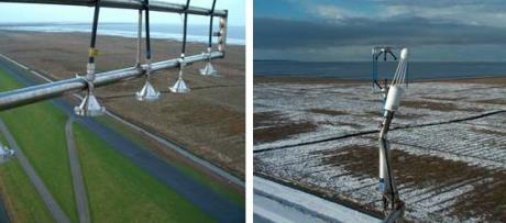
5 gas inlets at 60 m height; 3D sonic anemometer with infrared gas analyzer at 50 m height
...
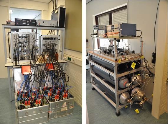
Autosampler (left) and Oxzala (right)
The auto-sampler flasks are used
to take hourly samples. All these flasks will be analyzed for all concentrations (CO2, CO, CH4, N2O and SF6) and stable isotopes and the radio-active gas 14CO2. Carbon dioxide samples are weekly or monthly absorbed in larger quantities (see photo below) using a column with sodium hydroxide (NaOH). Three columns are used: one is filled with northern wind for marine air, the second is filled with southern winds for continental air and the third is used for all wind directions to determine the long term average.
The distinction between maritime and continental air can even better be made from the mixing ratio of the radio-active gas 222Rn that is emitted at the continent from the decay of 236U while emission from the oceans and other water bodies is negigible. Another reason to measure 222Rn is that the almost constant emission from land enables the calculation of greenhouse gas emissions from the Netherlands using simultaneous changes in 222Rn and the greenhouse gas of concern (Van der Laan et al., 2009b). The method was also used for the major greenhouse gas CO2, but then the anthropogenic CO2 was first separated from natural emissions and absorptions of CO2 (mainly by vegetation) using mixing ratios of CO and 14CO2 (Van der Laan, 2010). 222Rn is detected using a two-filter dual-loop system with a flow of 80 l/min in a 1500 l delay chamber where 222Rn decay products are sampled on a filter and decay of the 222Rn daughters is detected by a photo-multiplier.
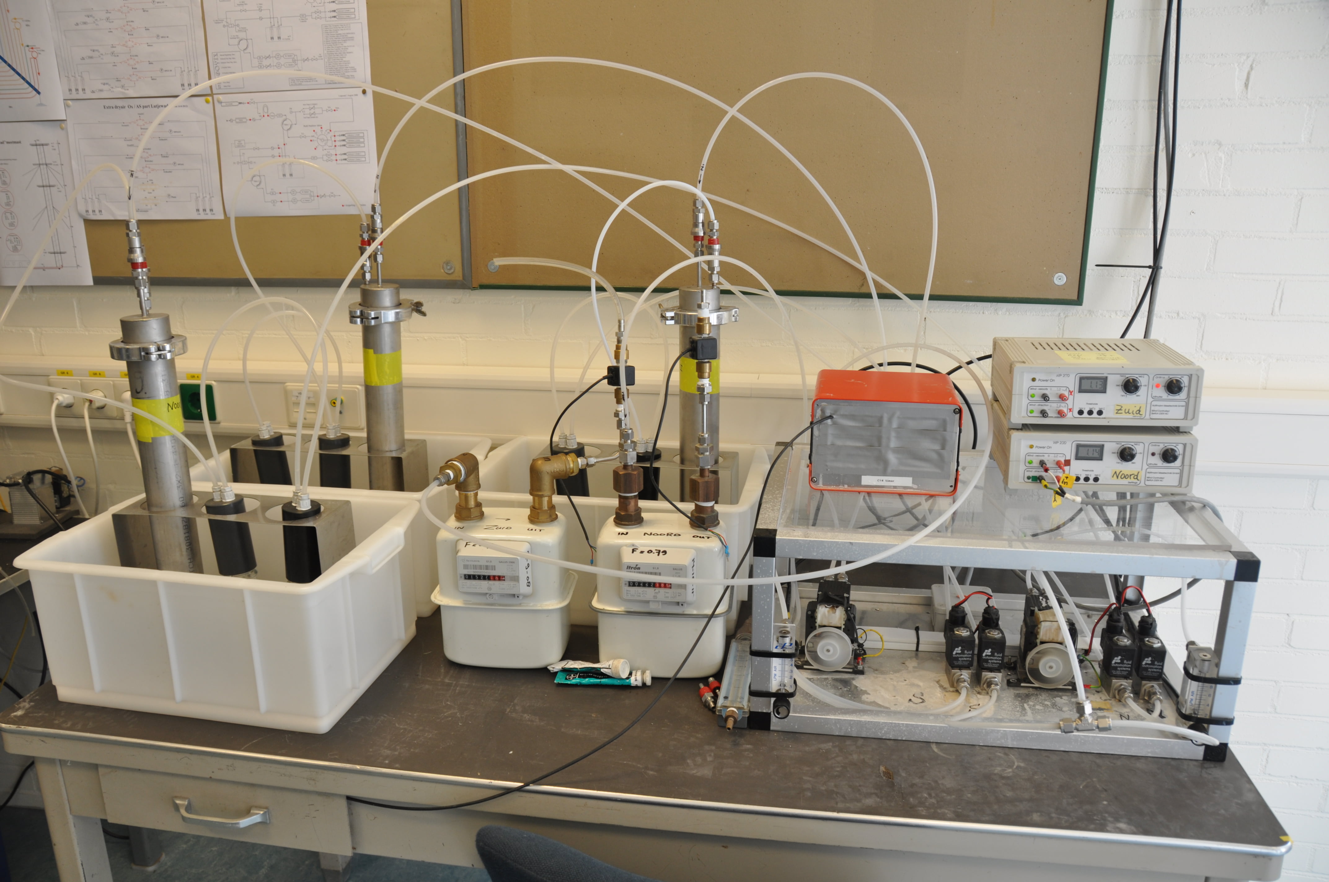
Absorption columns for C-14 determination (left) and ANSTO for Radon concentration (right)
...